 Whether hiking at Lake Titicaca or on the Inca Trail, climbing Huascarán or the volcano Misti – Peru’s mountain world promises hikers and nature lovers plenty of variety.
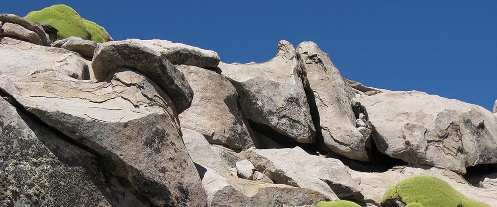
Inca Trail / Camino Inca
The Inca Trail in Peru is one of the most popular trekking routes in the world. It was part of an over 30,000 kilometre long Inca road network. Since it was rediscovered and uncovered in 1942, the flow of backpackers has not stopped. In the meantime, only a maximum of 500 people per day are allowed to hike it in groups with a guide.
Although it can get tight in the high season on the approximately 33 trekking kilometres, the view of snow-covered peaks, gorges and cloud forests compensates for the inconvenience. In three to five daily stages hikers march along the old, paved path from Valle Sagrado to the Inca city of Machu Picchu. It goes uphill, downhill, over three passes and past mystical Inca sites.
On arrival, for example along the river Río Urubamba, hikers get a first impression of the magnificent landscape. Then it’s off: the first eleven kilometres in hilly terrain are a breeze and help with acclimatisation. But when climbing up to the „Pass of the Dead Woman“ (Abra de Warmiwañusqa) – the highest point of the tour – it soon becomes clear that the whole thing is not going to be a walk in the park. At an altitude of more than 4,100 metres, the air can become quite thin. But when you look at the magnificent landscape from the Runkuraqay watchtower, all exertions are immediately forgotten.
One of the many highlights is the well preserved „city above the clouds“ (Phuyupatamarca) at a height of more than 3,600 meters. In order to reach the terraced temple complex with its water channels and stone baths, one has to walk 50 meters steeply down stairs. The sunrises and sunsets over the complex, which blends perfectly into the mountain landscape, are particularly charming. Finally, a feeling of happiness sets in when the legendary Inca city of Machu Picchu lies at the foot of the hikers at the sun gate (Intipunku).
Practical tips: Tourists need an official permit and may only hike in a group with a licensed guide. To get the permit, you should book months in advance, as the maximum number of visitors per day is limited to 500. The tours (prices vary per agency; price example: about $300 for four days, all inclusive) are offered all year round, except February. From June to August is high season, between December and April it can be wet and slippery. Hikers should be fit and prepared for sun, rain, nightly cold and altitudes up to 4,200 meters.
Hike around the Ausangate / Cordillera Vilcanota
The glaciated Andean peak of Ausangate (6,384 meters), southeast of Cusco, has been considered a sacred mountain since pre-Inca times. It was traditionally a place where offerings were made to the deities. Even today thousands of people, mainly Indians, make a pilgrimage to the north side of the mountain shortly before Corpus Christi to celebrate the „Snow Star Festival“ for several days.
The Ausangate was first climbed by Heinrich Harrer in 1953. If you don’t want to follow in the footsteps of the Austrian alpinist right away, you can also walk around Peru’s fourth largest mountain. This not so easy trekking tour is a worthwhile alternative to the Inca Trail. Crossing four passes at an altitude of around 5,000 metres requires stamina and good nerves. In return, a picture-book panorama of the Andes with glaciers and mountain lakes will entice you to go on this tour. But also the barren grasslands (Puna) have their charm. Llamas, vicuñas and herds of alpacas graze here. The landscape is never monotonous: After the next pass or in the next valley everything looks completely different again.
The tour around Ausangate starts in the village of Tinqui and takes five to six days. It goes slowly at first, then steeper and steeper upwards. After two pass crossings the highest mountain pass follows at 5,200 meters. The ascent to the fourth pass (5,000 metres) and the following long descent is also very strenuous. Once you have finally reached the first houses, the motto is: relax in the hot thermal springs. Because the next day another long march back to Tinqui into civilization is waiting for the hikers.
If you want, you can rent mules and drivers in Tinqui. Combined tours – on foot and on horseback – are also possible.
Practical tips: The ideal time for this tour is May to September. For the trek – best in a group – you must be physically fit and in good physical condition. Every hiker should be prepared for problems with the altitude.
Lake Titicaca
During a trekking tour to Lake Titicaca, the hiker does not cross any mountain passes. But therefore, the impressions at this magic place are the more intense. The biggest lake of South America with 36 islands is located at a height of 3,810 meters in the barren plateau Altiplano, framed by snow-covered Andes mountains. Here, nature lovers can not only go hiking, but also immerse themselves in the everyday life of the fishing villages, where traditions are still alive. And it never takes long until the next festival – especially in Puno on the Peruvian side, there are vigorous celebrations.
There are many ways to explore this surreal-looking landscape, for example on one- to three-day tours to the sun island (Isla des Sol). The tour starts in the colourful pilgrimage place Copacabana (Bolivia) and leads on a 17 kilometres long section to Yampupata, opposite the sun island. On the way that takes approximately three to four hours, one can fully enjoy the beauties of the lake. The colour of the water is deep blue, contrasting with the mountains in the background. Rush boats are rocking in the lake.
With the ship we go over to the Isla del Sol (Bolivia), the birthplace of the Inca. On an extensive network of hiking trails, visitors can discover interesting archaeological sites, for example the Inca stairs (Escalera del Inca), which lead from the shore in Yumani to the „Fountain of Youth“ (Fuente del Inca).
Also on the even more pristine island of Isla Amantani (Peru), four and a half hours from Puno, trekking routes to sacred Inca sites await hikers. The island is famous for its baskets woven from grass and granite sculptures. You can also hike on Taquile (Peru), with pre-Inca terraces on the hills. The car-free island, long an insider tip, has preserved its original lifestyle like no other. Here, in the absence of other options, the inhabitants carry everything on their backs and many men knot their woollen hats themselves.
Practical tips: The rainy season is between December and January. All year round it can get very cold at night. Although the sun usually shines during the day (be careful: sunburn!), a cold wind often blows. The altitude could also cause problems. In any case, you should bring sunscreen with a high sun protection factor with you on your trip and also think about insect repellent.
Volcano Misti
Very close to the picturesque city of Arequipa in southern Peru, another highlight awaits hikers: the cone-shaped, active volcano (Volcán) Misti. The landmark of Arequipa has even made it into the city coat of arms.
The ascent to the mostly snow-free summit takes about two days. The tour starts at 3,000 meters altitude in Cachamarca. After registration, a twelve-hour hike leads up to the Refugio Monte Blanco, a half-destroyed rock cave at 4,800 meters. The next day it takes another four to six hours to reach the summit.
An organized, easier route with porters, cooks and guide starts at 3,500 meters in Aguada Blanca. From here the group climbs up through bush land to 4,085 meters within two hours. After a short break, the group climbs up another 600 meters. Three hours later the hikers reach the base camp, the next morning after about four hours the summit. Even with snow you don’t need crampons. The descent to the camp takes two hours and in the afternoon the hikers are back at the starting point of their trek.
Practical tips: Again, hikers should keep in mind that the altitude might be a problem. Locals know best how to deal with the symptoms. If you are not yet acclimatized, you can take three days for the hike. One day treks are not recommended as the differences in altitude are too extreme and the tour could turn into an ordeal. As there have been attacks on the Aprurímac route in the past, it is advisable to take a registered guide.
Hike around the Ausangate / Cordillera Vilcanota
Walking through the landscape with llamas: This is pure Peru! On an old pre-Inca trail from the Andean community of Olleros to the ruins of Chavín, hikers enjoy the varied Cordillera Blanca to the fullest. The 37-kilometre-long tour leads through lush green valleys, past glittering lakes and snow-covered mountains. On the 4,700-metre-high Yanashallash Pass, the highest point of the trek, the air can become thin. On the other hand, the view of the imposing mountain landscape is all the more impressive.
The hike takes between three and five days. The night is spent in tents. The llamas are a great help with the luggage transport, especially when going uphill. If you are interested in the way of life of the locals, you can still visit original Andean villages and learn more about the inhabitants. At the end of the tour another highlight awaits the hikers: the ruins of Chavín de Huántar at 3.200 metres. The complex in the form of a temple castle with a sophisticated underground tunnel system was built around 1,000 BC and is considered the oldest Peruvian stone structure.
Practical tips: June to September are ideal for this hike as there is little rainfall. Those who go hiking without a guide should take a good map with them and pay attention to the signs in order not to get lost. Furthermore, one needs for this tour enough water, provisions as well as a good equipment. Possibly there could be problems with the altitude.
From Olleros to Chavín
Walking through the landscape with llamas: This is pure Peru! On an old pre-Inca trail from the Andean community of Olleros to the ruins of Chavín, hikers enjoy the varied Cordillera Blanca to the fullest. The 37-kilometre-long tour leads through lush green valleys, past glittering lakes and snow-covered mountains. On the 4,700-metre-high Yanashallash Pass, the highest point of the trek, the air can become thin. On the other hand, the view of the imposing mountain landscape is all the more impressive.
The hike takes between three and five days. The night is spent in tents. The llamas are a great help with the luggage transport, especially when going uphill. If you are interested in the way of life of the locals, you can still visit original Andean villages and learn more about the inhabitants. At the end of the tour another highlight awaits the hikers: the ruins of Chavín de Huántar at 3.200 metres. The complex in the form of a temple castle with a sophisticated underground tunnel system was built around 1,000 BC and is considered the oldest Peruvian stone structure.
Practical tips: June to September are ideal for this hike as there is little rainfall. Those who go hiking without a guide should take a good map with them and pay attention to the signs in order not to get lost. Furthermore, one needs for this tour enough water, provisions as well as a good equipment. Possibly there could be problems with the altitude.
Huascarán (6,768 meters) / Cordillera Blanca
Especially popular with extreme mountaineers is the ascent to Nevado Huascarán, the highest mountain in Peru and the fourth highest in South America. The Huascarán, which consists of two peaks (Huascaran Sur, 6,768 metres and Huascaran Norte, 6,652 meters), was first conquered by a German-Austrian expedition in 1932. This difficult trekking tour is only suitable for alpinists who can walk safely on ice with inclines of up to 50 degrees (frontal zigzag) and who are in very good physical condition for the ten-hour climb to the summit.
The expedition takes about six days. Via moraines the alpinists ascend to camp one at 5,200 meters. The way to Camp Two at 6,000 meters is very demanding, because on the way to the pass between the north and south summits glacier fractures and crevasses have to be crossed. Whether the north or south summit is finally climbed in the early morning over steep glacier slopes often depends on the weather conditions, whereby the south summit is considered to be the less dangerous.
Practical tips: Only extreme mountaineers with excellent physical condition can join this tour. They must be trained in ice and glacier walking and know how to deal with frostbite and altitude sickness.